The weather last night was perfect for camping - calm, clear, and cool. Death Valley National Park is famous for Badwater Basin, hundreds of feet below sea level, but I had spent the night at almost 4,000 ft. The plan for the day was to go up and over Hunter Mountain (over 7,000 ft.) then down to Badwater - and get out of the park before noon, when things would really start to heat up.
To that end, I had the tent taken down and everything packed away well before sunrise. The seven rough miles back to Teakettle Junction were even more difficult to negotiate in the inky blackness, but I just took it extra slow. These are the times those $300 auxiliary lights in the catalogue would come in handy.

At Teakettle I hung a right - the straight path is where I had come from the evening before. The sign says 27 miles to Hunter Mountain, but I knew the dirt road extended far beyond that, down the other side, before finally joining the pavement in Saline Valley. How much farther, the map did not say.

When it finally got light enough for a non-flash picture, I found myself in some rolling hills on a high plateau, dotted with Joshua trees. The most difficult part of the road in the dark had been the deep sand and dust washes, that were hard to spot until I was in them. My street oriented rear tire did me no good there, but I was still able to make it through.

This part of the trail was great fun, as there was plenty of light now, and the surface was fairly solid and smooth! I had gone over a rounded hilltop, which I took to be Hunter Mountain, taken a left at an unmarked junction, and was soon descending toward the valley far below. I'd be on the pavement soon and headed for breakfast!

And then, the road ended abruptly at the remains of a miner's shack!
I had passed the mine a bit before, and there was even a rusty old 1930's truck in the sage brush. Evidently this was a popular destination - more popular in fact than the through-road I was looking for. My rule of thumb had failed me. Nine times out of ten, the most well traveled fork is the one that goes through to the pavement. The other(s) are dead end spurs. This was one of those tenth times.

The sun came up as I backtracked the 2 or 3 miles to the last junction and hung a left. The more I thought about it, the more I realized the error in my thinking. I reread the trail description. It stated that Hunter Mountain was covered with trees. I had not seen any trees since the day before. Evidently, I still had to climb Hunter Mountain before heading down to the valley.

Sure enough, before long the road began to ascend some steep switchbacks.

And then I passed the first of many stubby pine trees. This one, in fact, reached out and put some scratches in my right pannier. That wasn't nice. But I was feeling good - much more confident that I was on the right track.

The top of the mountain was rocky and narrow - the most technical section I've had the big KTM on to date. The map showed a few miles of 4 wheel drive road as opposed to just 'high clearance.' That must have been it. I was concentrating too hard to stop and get a photo, evidently. The section shown above was where the road smoothed out again.

And then - another unmarked junction. I'd been expecting a major one down in the wide valley, but not way up here. I finally had to face the facts. I should have brought a better map.

I climbed one of the hills to get a better idea of which direction each of the roads was trending...

...and consulted my handy dandy compass. The right fork was heading northwest, more or less, and the left one, southwest. That matched a point labeled 'South Pass' on my rather poor map, and if indeed, that is where I was, the left fork is the one I wanted. Again, that was not the one that seemed to be more traveled. A correctly used compass does not lie, however (unless you're standing too close to your bike, or to iron-bearing rocks - a definite possibility here). I took the left, regardless, and hoped for the best.

Eureka! Before long, I was down on the wide, flat valley floor, making up for some lost time!

The road had been a bit of a stretch for my sport touring tire, but she'd gotten me up and over, with only a couple of unplanned, extra exciting moments.

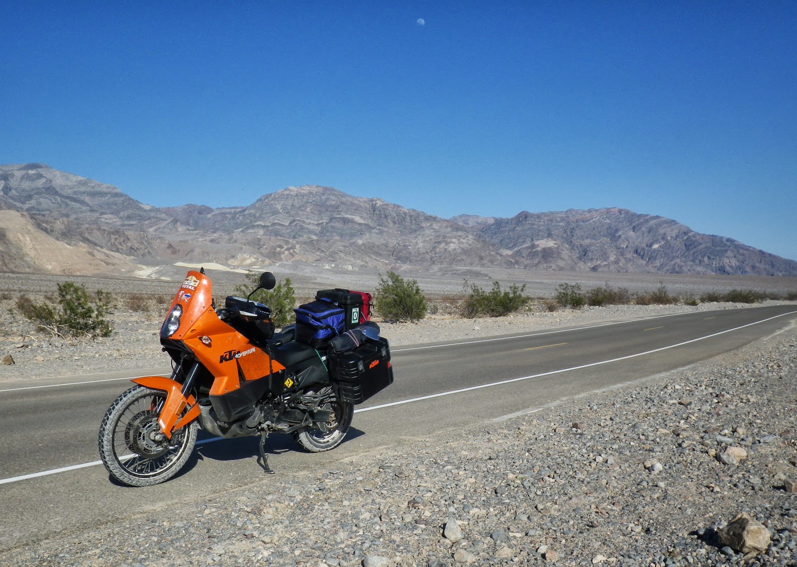
Looks good from every angle, don't you think? I'm probably starting to lose some of my less moto-focused readers at this point, but this post is only a few more pictures long. You've almost made it!

I finally reached the pavement - about 15 miles and an hour and a half later than I'd anticipated. With all the potholes, it turned out to be rougher than the gravel. And only lasted a couple of miles before reverting back to crushed rock.

By the time I reached the real paved highway, the sun was beating down pretty good and the temp was climbing.

I looked back and took this photo of all the warning signs for the road I'd just come over. The yellow one in the background says, "Caution Severe Washouts."

Hanging a left on highway 190 took me down some amazing switchbacks to the Panamint Springs campground, restaurant, and gas station. Fearing to spend too much time there, I skipped breakfast and sipped down a large ice-filled glass of Pepsi instead. It was already 90 degrees and I still had about 75 miles to go to Badwater Basin. Should have left earlier.