Here in the Pacific Northwest, we had a crazy warm spell, relatively early in the spring this year. It also happened to coincide quite nicely with a business trip my wife had to take to Kansas City. So....

I saw Kim off at the airport around 5:00 am on a Saturday last month, drove the hour and a half back home, did some last minute loading, and headed south on the KTM! I had to plan my route carefully, as many of the mountain passes were still known to be snow-bound, or at least questionable. After I got over the coast range summit, I stuck to the freeway - not as bad as it sounds, once you get past Roseburg, OR and begin to climb. I had checked the highway cams the day before, but after leaving in a slight drizzle, was relieved to find the Siskiyou pass (highest on I-5) not only snow-free, but pleasurably warm and sunny.

The California line, less than 10 miles farther, marked new territory, not only for the big orange beast, but for yours truly on any motorcycle.

I pulled out out my Sharpie and colored in yet another state on my top-box sticker. Somehow I'd missed Arizona on my coast to coast trip last spring, and I knew I wouldn't get there this time either. No worries. That will make a good excuse to head south again next year! You may have also noticed that Washington, less than two hour's from my garage door, remains shamefully white as well. I hope to take care of that later this month, on a two-up northern lighthouse tour with Kim.

I left the freeway at the quaint little town of Mount Shasta. Yes, that's 14,162-foot Mt. Shasta, one of California's 12 fourteeners in the background. OK, it depends on how you differentiate one peak from another. Some say California has 14 fourteeners. They're probably Californians. Or perhaps just people who like alliterations. For comparison, Colorado has 56, if memory serves.

Highways 89 and 44 tunnel southeast, through an almost uninterrupted forest. A series of large meadows outside of Susanville provide a welcome opportunity to lift your eyes a bit farther into the distance.

My AAA map showed a campground in the tiny village of Millford, on the shores of Honey Lake. At sunset, as I approached the spot where I thought the town must be, I saw this sign.

What I didn't see, was a campground. Before leaving home, I'd debated whether to spoon on a new rear tire. The current one was more or less designed for street only use, and had deposited most of it's rubber along 5,000 miles of highway between Key West, Florida and Netarts, Oregon. It still looked as though it had a couple thousand miles left, however - and even though I planned to ride over a hundred miles of unpaved road in Death Valley National Park, they would be primary unpaved routes, likely well-graded and hard-packed, right?
So, the street tire had stayed on, and I hadn't given it another thought, until now. It doesn't look so bad in the photo, of course, but this deep, loose, sandy dust mixture I immediately found myself in, turned out to offer some of the least traction of any road on the trip.
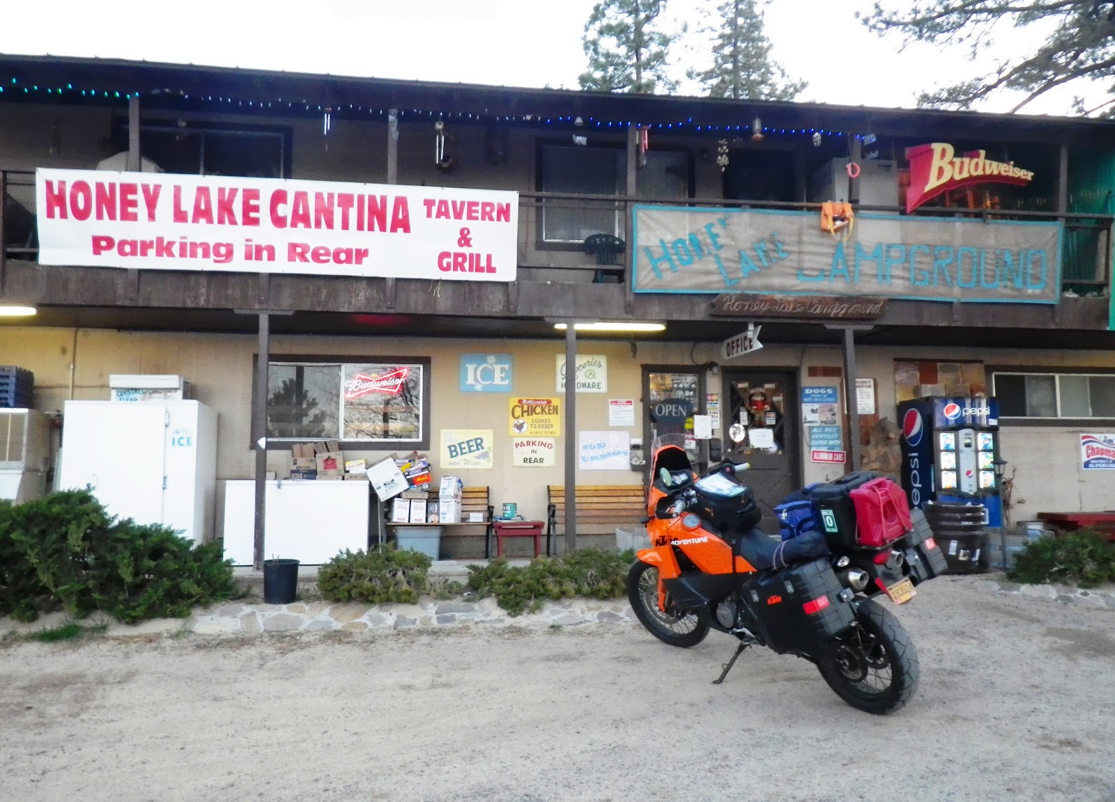
I did make it up the hill, however, to another sign, and then to the Honey Lake Cantina and Campground. The "Grill" part of the sign especially appealed to me, as I had eaten nothing but an energy bar all day. Alas, however, the kitchen was closed and the door was locked!
There was a bell. When I rang it, a woman appeared on the balcony above me. She came down and opened the door, took my money for a tent site, and apologetically offered her selection of camp store dry goods.

I scanned the items and quickly noticed the cans of Vienna Sausages! Check. I continued my scan but couldn't come up with anything else that sounded good. I bought two cans of Vienna Sausages and one bottle of sports drink -- Dinner!

After eating, I set up the tent behind the store, in a pleasant area surrounded by tall pines. Moments later, I realized that one can of Vienna Sausages is very good... This I already knew. But two cans of Vienna Sausages is very bad. Fortunately, the restroom was very close.


