Motorcycle Trips of Somewhat Limited Scope -- Accounts of More Ambitious Journeys Available as books on Amazon!
Wednesday, November 23, 2016
The Parashant: Kelly Point
Just past the gate, the pine forest disappeared, and the road became narrow, but fast. This must be the meadow the monument staff are trying to protect by closing the road in winter. I could imagine how muddy it would get after a few storms.
I arrived at Waring Ranch at 12:30. Jonathan Waring homesteaded here in the 1920's, and by the 60's had acquired 13,000 acres of grazing land - the largest private holding on the Arizona Strip. Not sure what happened after that, but it was pretty quiet the day I rode through.
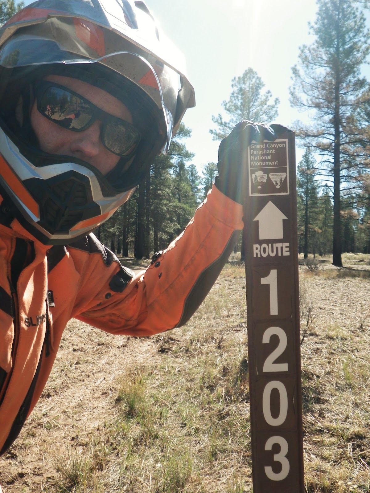
The tiny barn behind me was the only other structure I encountered the entire day. Under the shade of that large tree, you can see what looks like a speaker's podium. It's actually a solid steel box, with a hinged top - like those commonly found at backpacking trail heads.
Inside was a log book, a stack of maps, and two unopened bottles of water. Very thoughtful of them, I mused. The maps were originals of the one I'd printed off the Internet. I'll take that, thank you. I still had almost a gallon of water with me, so I left those for someone who might pass by later, perhaps in desperate need.
Now to the log. I entered the usual information - date, state of origin, number of people and vehicles, purpose of visit. And there's always the comment section. The one highlighted in yellow mentioned a prescribed burn, and warned of the possibility of falling dead trees. I'd keep my helmet on. Another mentioned mud holes, but that was back in August. What to say? I imagine most visitors don't think much about what they write in these, but I probably tend to think about the unthinkable, more than most. For me, it's a somewhat solemn occasion - especially since I noticed that no one had made an entry in an entire week! I wrote, "Plan to be back tonight." If someone came along in a day or two and saw that I had not 'updated my status' perhaps they would look under a bush or two on their way out.
Then, having covered the possibility of a late return, I addressed the possibility of a no return. After all, this could be the last written word from a Mr. Troy L. Ramsell. I added "Jesus is Lord!" put down the pen, and closed the lid. After all, nothing else really matters.
Having crossed the remainder of the meadow, it became immediately clear that this was, indeed, the start of the 4 X 4 Jeep trail. The path was almost completely full of basket ball-sized and larger boulders. With extreme care, I was able to pick my way around and between most of them, but some left no option, but going directly over the top. In these cases, I was glad for rather extreme ground clearance, stout long-travel suspension, and the tough skid plate under the KTM's vital parts. Even so, I found that if I happen to get stopped with either wheel on top of one of the big ones, it was an extra long reach to the ground! More than once, I was barely able to find the right purchase for my foot, to keep the bike upright. Of course, getting started again from this position - rear hanging off the seat, arms nearly over my head, was far from the easy part. If this did not get better soon, it was going to be a very long 26 miles to Kelly Point!
It did not get better soon. Of course, the pictures don't quite do it justice, but you get the idea. You may have noticed from previous shots that I left my spare tire and taller wind screen at my friends house. I also took all non-essentials out of the saddle bags - clothes and rain gear, mostly. But the tools and other emergency gear had to come along. A 250-pound dirt bike would have been ideal for this portion of the trip. My bike weighs twice that! It was going to be an exhausting ride.
This dry creek crossing broke up the monotony of boulder hopping, but presented its own unique challenges. The bottom was deep sand, and the other side was much steeper than it looks. I'd seen a picture of it in a Jeeper's blog, and seemed to remember the author saying it was one of the worst spots. Once past it, that thought was reason for hope that the trail would soon improve.
And improve, it did! I had actually considered turning back in the middle of all those rocks. Only two thoughts kept me going. One, Kelly Point was THE destination of the trip. I've mentioned before that wandering is not my thing. My outings are very goal driven. Two, it simply HAD to get better - didn't it?
This section was smooth, wide, and level - all relative terms of course. I was nearly tripling my average speed - from 7 to 20 miles per hour!
The euphoria lasted about two minutes - until this tree blocked my way. The trail was crossing another meadow, this one with 18-inch deep ruts. What had once been mud was now rock hard. It wasn't slippery, but that didn't make the ruts any easier to get out of. When the one I was following led me here, I had to stop, lean the bike almost to the point the left engine guard was scraping bottom, and carefully feather the clutch to get by.
By the time I made it to the 21 mile point (that's 5 miles left to go) I was so exhausted I had to stop and take a break under what little shade was available beneath the stunted trees. It was only 76 degrees, but I'd been going so slow and working so hard to keep the bike vertical, that it felt much hotter. No, the jacket was not helping with my core temperature, but long ago I'd given up dodging all but the stiffest looking branches that jutted into the trail. And thus, I'd taken some pretty good hits to my arms and shoulders. There was no way I was making it without the protection of that jacket.
Those wide saddle bags were getting abused as well. Yes, I probably could have left them back in town, but I would have had to strap a lot of gear higher up on the back of the seat, raising the bike's center of gravity, making it harder to control in the loose stuff. But it was really hard to say which situation would have been worse.
I took off the jacket, guzzled a lot of water - and again considered turning back. At this point, even if the trail got better, it would still mean 10 additional miles before I was safely back to the pavement. I was not going to make it by dark. I was way in over my head this time.
But after a few minutes, the shade and water began to have a positive effect. I'd just take it easier. No rush. I'd told my friends there was a good chance I wouldn't make it by sunset, so they wouldn't be worried. It was only five more miles. And there was no way it could get any worse than what I had already gone through.
But it did get worse! Next up was the plague of softballs. Only these were not soft at all, but iron-hard and sharp edged! You can make out a narrow strip of stone-free trail on the right edge, but it ended at the next tree, and the pit of loose, tire-devouring vermin continued as far as I could see. I was glad I'd decided not to swap that front tire. Sure, the new one would have given better traction on dirt and sand, but made of softer rubber, it would have been more likely to puncture.
There was nothing to do but ride down the center and try to keep the front wheel straight, so it didn't catch and toss me over the bars. At least it was slightly downhill, so I could take my time.
The remaining five miles, somehow turned into six, but finally the trees got even shorter, and I could see nothing but blue sky between them. I must be close! I was actually going to make it!
But the feeling of impending euphoria was tainted with one of dread. That had not been the only stretch of "softballs." There were at least three more, and two of them were quite steep. Mid-way down one, a troubling thought occurred to me, "How am I ever going to make it back up?" Again, I considered turning around, but again convinced myself that the worst was behind - and continued.
Oh, there was one more thing that disturbed me so much I could not even bear to consciously take a picture of it. Beginning to appear shortly after the softball fields, they are hidden there, in the shadows to the right of my faring - CACTI! Fortunately, most of them were just off the trail and avoidable, if I was paying close enough attention. Because of other obstacles, however, I often had to pass within a few inches of their long stiff needles. I knew from experience that bicycle tires didn't stand a chance. I didn't want to find out about motorcycles.
And then... Everything dropped away!
I parked the bike - far from the edge - and slowly panned left.
And left...
Still left...
And back to the rim again!
BEHOLD! The Grand Canyon!
I stood for a moment, dumbfounded. Though I've seen it many times, from multiple vantage points (including bottom up) there is still no fully adequate response. "Amazed, astonished, astounded, awestruck... stunned, and stupefied." Yep, a quick consult with Webster verifies I chose a pretty good word. I'm one of those crazies who thinks it was mostly formed quite rapidly - like from the receding of a cataclysmic, world-wide flood. So I'll add "affirming" to that list of mostly "A" words.
I walked back to the bike, and yes, I did take off my helmet. And immediately, a pungent odor was unmistakable - GAS!
Saturday, November 12, 2016
The Parashant: Easy Part
It was already 9:30 when I crossed the Arizona state line and the pavement immediately ran out. I know, I know - that's a decent Harley start time, but a KTM rider should know better! In my defense, I had left my friends' house an hour before. Since then, I'd ridden 30 miles to this same junction, then three more in the wrong direction to fill up with gas at the closest station - and I really filled it up good! After topping off the two main tanks, I put 1.5 gallons in the Kolpin jug on the back, then set my little 1.5 liter Sigg bottle on the pavement and dispensed half a gallon from the pump. Unfortunately, half a gallon is about 1.9 liters.
Fortunately, my feet were not in the way, and the spilled fuel evaporated quickly in the bright morning sun. With my OOPS for the day already behind me, things could surely only get better! I knew I had about 75 miles of gravel to traverse, before arriving at the trail head; and if these first few miles of well-graded and hard-packed rock were any indication, this part was going to be fun!
Besides the new windscreen, I was also sporting new shades on this trip. By far the most money I've ever spent on sunglasses, these polarized, UV-blocking, anti-glare precision ground lenses are the best there is - according to my eye doctor. And when I first put them on, I could immediately tell the difference! Objects that would normally be hidden in the glare on a sunny day, or faded into the background on a cloudy day, stand out in heightened contrast. And the increased peripheral vision clarity reduces eye strain in a way that can really be felt by the end of a long day in the saddle. Besides not being able to see clearly past the tips of my fingers without corrective lens, I've been having other eye problems lately. And when I told my new doc how much riding I do, he said I should try a pair of Maui Jims.
OK, that's the end of the commercial. Where do I pick up my check again, Jim?
Alright, continuing backwards in my story, before the gas station, I was at McDonald's. But it was breakfast, so that makes it OK - quit their burgers decades ago. And my friend was buying, so that makes it even better! Ed meets a bunch of friends there every weekday morning, and when he offered to take me, I couldn't resist. Knowing it was going to be a physically demanding day, I figured fueling up the body as well as the bike, for a change, would probably be a wise use of time. As a bonus, their cheerful greetings and insider stories made me feel like a local in a town where I'd only spent one night. I was a little surprised, however, that with all the combined years of desert life experience at the table, no one had even heard of Kelley Point - only a hundred or so miles to the south. They wished me well though, and looked forward to the report of my safe return.
After leaving the restaurant, we'd made one more stop, at the auto parts store, to get an anti-ethanol additive I'd run out of earlier in my trip. Not only does it counteract the nasty gunk that corn based fuel leaves in your engine, but it increases gas mileage back to what it would have been, if you were running on 100% petrol. And on this day, I was going to need all the mileage I could get to make it back to the pavement!
Returning to the present, after dozens of beautiful, solitary, unpaved road miles, I came to a junction with a sign, bearing the names of places I'd been 15 years before. My first KLR, a 1997 model, had brought me safely to and from Mount Trumbull and Toroweap, to the east (left fork), when we lived in Kanab, UT. Now it was finally time to explore this western end of the "Arizona Strip." Comprised of all the land in Arizona north of the Grand Canyon, this region is larger than the state of Massachusetts, but has very few paved roads, only two real towns, and is home to only a few thousand people. It's the perfect adventure bike destination!
The junction in the photo above was far from the first I'd encountered since leaving the pavement. Still resisting the global tide of GPS navigation, I consulted the paper maps I'd slid into the top, see-through pocket of my tank bag. On the one I'm holding, printed off the Internet, I'd marked my route with a highlighter. Showing only primary unpaved roads (an oxymoron, perhaps) it was great for a quick look. If I really got lost, however, I had the yellow one behind. It folds out to the size of my dining room table, and shows every tiny track, down to the cattle paths, I believe!
To the right, the sign indicated I'd find Mount Dellenbaugh, which I didn't think was along my route. But there it was on the map, a bit to the south of my road, so all was well. The sign also indicated "Parashant" in that same direction - the first mention of the monument I'd seen on the ground. I'll admit, I felt a little better after that! Sure, a GPS would make things much easier. But if I wanted easy, I could have just gone to Vegas.
The next road sign was even more helpful, as it confirmed that I was indeed on the official route to Kelly Point! I'd read about the seasonal closure on the Internet. Evidently there are some meadows that can really get destroyed when wet, and winter is the rainy season here. Hopefully, all would still be nice and dry today. There was certainly no rain in the forecast, and when I'd called a few days before, monument staff was not aware of any washouts on the trail.
So far, navigation through the "Strip" had actually been much simpler than many places I've ridden. The signs had not yet been stolen, nor even used as target practice!
And there it was! I've entered through the "back door" of many parks and monuments on narrow dirt roads and taken pictures of tiny, beat up signs on the boundary, this was very different. I guess in this case, I was at the front door, as there are no paved roads leading into Grand Canyon - Parashant National Monument. I liked it!
First order of business was to get the extra weight off the luggage rack and into the gas tank. I'd recently passed the '60 miles from the gas station' mark, so all 1.5 gallons should fit - and it did. That means I was averaging about 40 miles per gallon. All's well so far. Just as I snapped the gas cap closed again, an old livestock truck full of sheep and leading a huge plume of dust drove up. Signaling to the driver that all was well, he waved back and continued on his way to town. Evidently, there are still some operating ranches down here. Nice to know I might not be completely alone after all.
At the junction to Mount Dellenbaugh, I believe, the gravel ran out, and I found myself on a native dirt surface. You can see the deep ruts made by trucks who passed through when it was last muddy. But now it was all dry again, and the going was nice and smooth. If it was like this all the way to the point, I'd be there in no time!
Just across this brand new cattle guard, I passed through an open, solid steel gate. This must be where they close the trail each winter. The pine forest was a welcome change of scenery after all the sage brush, but I had a feeling it wouldn't last.
The Parashant is a joint management effort between the Park Service and the BLM. This sign indicates I'm getting closer to the rim! After the sheep truck, three monument vehicles had passed me heading out. At first, I was pleased there was an official presence in such a remote place. Then I thought, "Those are probably the last of the staff, going home to St. George for the weekend!"
From the gate, the "Jeep" trail portion of my route to Kelly Point was marked with these thin brown posts. It was supposed to be 26 miles to the Grand Canyon overlook from here. I figured at worst, I could average 10 miles per hour on this part. That would mean about two and a half hours out. But the way it looked so far, I might make it in half that time - and it was barely noon. Morale was running high!
And then I spotted this flyer, stapled to another post. Floyd Roberts had been missing for quite a while - last seen June 17. It was now October.
I had lots of water, fuel, tools, an emergency shelter, an extensive first aid kit, and friends who knew where I was going and when I planned to be back. None of that could guarantee a safe return, I knew, but I felt I was as prepared as anyone could be.
Well, there was one more thing I could have done. Just before leaving home, I'd come the closest I have yet to purchasing a satellite locator and communicator. I knew there would be no cell service in the Parashant, but that was really nothing new. Most of the roads I've been riding in northern Canada lately are out of phone range as well. The difference is that those roads, while rough and remote, are the only routes between the towns. As such, it's never terribly long before another vehicle happens by. In parts of the desert southwest, off the proverbial 'beaten path,' however, it might be days before anyone else has a need or desire to pass your way. Parks and monuments are usually fairly well visited, but the Parashant is not your typical family road trip destination. Just how far off the 'beaten path' was Kelly Point? I didn't know.
I put off the decision. Was it the expense, the bother of keeping one more electronic gizmo charged and ready? Or was it deeper than that? Did I fear that having a device that promises to keep me one press of a button from rescue and civilization would be giving up too large a piece of what makes my trips so appealing and satisfying? Would I be giving in to modern society's relentless push to take all the risk out of life - and with it, all the reward?
As with all decisions, if you put them off long enough, they are made for you. Or in this case, it might be closer to the truth to say that failing to make a decision in time, I was, in fact, deciding to keep the status quo. Either way, departure day arrived, and I was not packing a satellite device.
I said a prayer for Floyd, and his family - and for myself - got back on the bike, and continued south, deeper into the Parashant.
Saturday, November 5, 2016
The Parashant: Visitation or Invasion?
If it wasn't for that mountain, the sun would have begun working its magic a lot sooner on that second, very chilly morning of my trip to the Grand Canyon-Parashant National Monument. Located just to the west of Grand Canyon National Park on the north rim, The Parashant is almost as large, and believe it or not, even more remote. There were really three reasons for this particular destination, in no meaningful order.
One - Kelley Point, the southernmost extent of the monument, had been my goal back in 2001. I was riding my first Kawasaki KLR650, a '97 model. Living in Kanab, UT at the time, it was only a day trip, but I got distracted by several other tempting roads along the way, and never made it to Kelley Point.
Two - I had not yet ridden into Arizona on my KTM, and that was the only remaining western state to be colored in on the RV sticker I had plastered to my top box before my first long ride on the orange bike in 2012.
Three - Friends of ours from our Utah days were now living in St. George, and I hadn't visited them there yet - and their house was only minutes from the end of the pavement!
Behind me, I could see that the ridge tops were being lit up, but down here in the valley, it was still hovering in the mid twenties! When I left the hotel in Cedarville at 6:30 it was a balmy 35 degrees, but it was still dark then. Indeed it is true that there's always a dip in temperature right after it gets light. Fortunately, it was a dry morning and there was no frost on the pavement.
By the time I made it to Gerlach, Nevada - even smaller than Cedarville - I was soaking up the sun's rays like a lizard on a rock. Slowly, the shivering subsided, and full blood flow returned to all the extremities. My new taller screen helped reduce the wind chill factor, but anything below freezing is just cold, even standing still. If I'm going to do more rides in the fall, I may need to break down and invest in some heated gear!
Pyramid Lake, about 20 miles north of Interstate 80, was the landmark that signaled my return to civilization. After turning in the night before, I had considered detouring down the High Rock Canyon Jeep trail today. Located southeast of Cedarville, the original plan was to do it on my way back, adding a third day to my return to Oregon. But that was before I changed my route and went south from Klamath Falls instead of east, bringing me much closer to the canyon. Before falling asleep, however, I had decided to continue with Plan A, attempting to make it to the St. George area in only two days, despite the fact that I hadn't yet reached the half way point at the end of Day 1.
Part of my thinking was a reluctance to call my friends and tell them I'd be a day late. I'd already postponed my trip by a week, due to an enormous storm that brought 85 mph winds and even a tornado to the northern Oregon coast! Then there was my rule of thumb to always accomplish the primary objective before taking side trips. What a shame it would be to run into some sort of trouble down in the canyon that would make it impossible to continue to the Parashant and cross Arizona off my list. Final confirmation had come with the dark cold of morning. A narrow deep canyon simply did not sound like a fun place to be.
Things were going quite well after sun up - until I hit road construction outside of Tonopah. I'd only gone 435 miles before stopping for the night at the JnR, so according to my calculations, I had to make 765 today. That would not be easy. For off-freeway travel, I can normally average only about 50 miles per hour, including stops. That sounds slow, I know, but on a motorcycle, you have to stop for every little thing - drink of water, switch to sunglasses, remove quilted jacket liner, clean face shield, etc. Then there's photos and gas, of course. Even though I can go 200 miles on a tank, the spacing of fuel stations is rarely ideal, so I'll end up stopping more like every 140 - much more frequently than in a car. All that considered, I could be looking at a 15 hour day. I left at 6:30 am., so that makes an arrival time of around 9:30 pm. - if all goes well. Oh, I forgot about the time zone boundary. Heading east that adds an hour. Make that 10:30. Ouch.
They call Nevada 50 the "Loneliest Highway in America," but I don't think "They" have ever traversed 375. I could have stayed on 50, but it wanders around quite a bit, and today I needed the most direct route to southern Nevada I could get. And that's how I ended up here. What, you say you can't read that sign?
How's this? All the stickers still make it difficult, but yes, the official highway sign reads "Extraterrestrial Highway Nevada 375." Conveniently in this case, the shortest path between two points was also the most interesting, as 375 runs near the northern boundary of Nellis Air Force Range, home of Top Secret Area 51.
More than 100 miles of basically empty desert past Tonopah, I spotted this nicely paved road to the south. Could it be? The little green sign reads CEDAR GATE. Gate to what?
A quick Internet search after my return brought up reports of large white trucks going in and out at all hours of the day, and of the high frequency of "sightings" in the area. Then, when I uploaded this picture, I noticed the multiple white horizontal streaks in the sky, and four rainbow colored vertical ones, just to the right of my motorcycle.
Of course, I didn't notice any of that while I was there, so I thought it would be a good time to add my spare fuel to the tank. Back in Tonopah, I'd put an extra gallon in that red jug, just in case. I didn't know if any of the small towns ahead would have gas, but it was obviously a long way to any larger ones. Just as I finished, a large unmarked SUV with government plates drove up from the direction of the CEDAR GATE. As it came to a stop beside me and the window rolled down, I wondered if I'd been seen taking photos, and was about to have my camera confiscated. "Everything OK?" the woman called out. I gave her a "thumbs up" and she turned onto 375 and sped away.
As it turned out, getting some extra gas was the right decision. It was over 190 miles to the next station in Caliente, and with the higher than average Nevada speed limits, I wasn't quite making my normal 40 miles per gallon. The closest things I saw to alien life forms were these Joshua Trees in the distance - native to the Mojave Desert. The best thing about this scene was that, unlike all the other times I've been this far southwest, the temperature was only 76 degrees!
I called my friends just before dark from Panaca, 19 miles west of the Utah border. I told them it would still be a couple more hours, and that if they didn't want me to arrive so late, I'd just spend the night here. Ed insisted I come on, and in almost exactly that amount of time, I found myself pulled up next to his gracefully aging Beemer - a BMW he's had since before I met him, over 15 years ago.
The local time was 8:30. Total miles that day had been only 725 - not sure where that other 40 went - and I'd averaged 56 rather than 50 mph. Not bad. Thirteen hours in the saddle was a pretty respectable day. But tomorrow would be the real test.
Subscribe to:
Posts (Atom)