Motorcycle Trips of Somewhat Limited Scope -- Accounts of More Ambitious Journeys Available as books on Amazon!
Saturday, May 25, 2019
The Colville: Complications
After lunch in Omak, we followed Highway 155 east, then a bit south to Nespelem, the largest community we'd encountered yet on the reservation. Remaining on that primary thoroughfare would have taken us back down to Coulee Dam, so we turned off onto Cache Creek Road, to continue our west-to-east crossing of the Colville.
Immediately, we began ascending into the forest again, via some well-paved, entertainingly tight switchbacks. So enjoyable were they, in fact, that we neglected to stop for any photos!
Once over the high point, we were soon back on 21, in the same valley where we had first crossed into the reservation on the Keller ferry that morning. This time, we headed north briefly, before taking yet another turn to the east, onto Bridge Creek Road. We knew this would be the section with the most potential for problems. Our maps showed it topping out at nearly 4,000 feet - and only 50 miles from the Canadian border. This early in the season, patches of snow were still a real possibility.
There were two other ways over the mountain, one was much lower, but appeared to have a long unpaved section. The other was even farther north, outside of the Colville, and over 1,000 feet higher! Of course, we could always go back the way we'd come - but that would certainly feel like failure at this point.
And then, the first drops of moisture appeared on my face shield.
As these thoughts ran through my head, we suddenly found ourselves on a gentle descent. With no sign of higher country ahead, we surmised that we must have crested the summit without realizing it. I got off the bike to snap some photos, just as the sprinkles turned into snow! I know you can't see it in this photo, and it's not like they were huge, fluffy flakes - but it was indeed frozen precipitation.
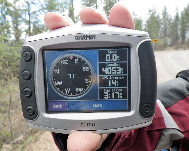
Dan detached his GPS from its holder and showed me the elevation reading - 4053 ft. That was probably fairly accurate. The temperature, shown in the middle of the compass (71), was not! Evidently, the heat rising from the engine of his parked motorcycle was having a substantial influence on that reading.
After we left that spot, my bike was showing an ambient temp. of 42 degrees. Probably no danger of the snow sticking to the pavement, but if you look carefully at that previous picture again, the factor we ended up dealing with for a dozen miles was left over pea-gravel. Spread during icy conditions over the winter to increase traction, it had not yet been graded off the road surface. In fact, the piles got deeper as we descended, so that at the worst point, there was hardly enough bare pavement in the wheel tracks for a single motorcycle tire. We dropped our speed considerably, as we were forced to follow that narrow line, or risk having a tire sliding out from under us.
I began to fear that a truck would fly by - in either direction - and spray a barrage of buckshot-like rock in our faces. And then, in my mirror, I saw one approaching Dan from behind. Immediately, I began looking for a place to pull over, but there were no turnouts, and no easy way to get over the mountain of gravel and onto the shoulder anyway.
I noticed the truck coming out to pass Dan, and then a junction appeared just ahead, where the gravel was significantly less. I pulled well over onto the side road and waited for my friend to join me - hoping he and/or his bike hadn't been hurt.
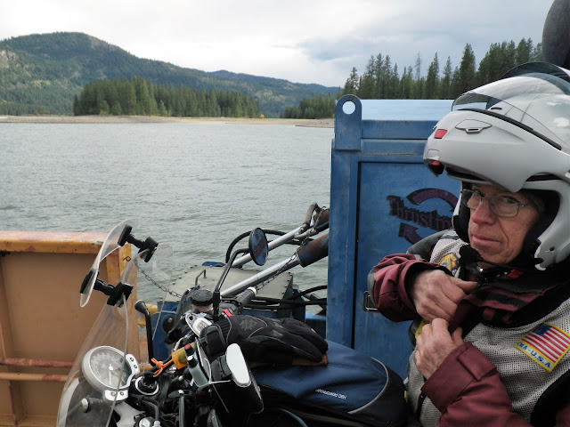
Dan's report was positive. The driver had passed carefully, perhaps cognizant of the potential for danger. Soon we were back along the banks of the Columbia River, and as we made the final turn towards the dock, we realized the ferry was currently loading. We rode right on to the 'Columbian Princess', without even having to stop!
And so ended our trip across the Colville. Down at lower elevations once more, we opened up our jackets a bit and tried to relax. I say 'tried' because there was one other issue I haven't mentioned yet - fuel. We'd gone about 90 miles since topping off in Omak, and Dan likes to refill around the 100 mark, if possible. There was supposed to be a station in Inchelium, the ferry town, but we hadn't seen one, and the GPS said the closest was five miles in the wrong direction. Since I had 150 more miles worth in my tank, I'd naturally made the decision to press on! That's what friend are for, right? Spurring each other on to face the odds and go for the gold! I also knew that I'd put an extra gallon for Dan in my spare fuel can - just in case.
Once across the river and onto Highway 25, we had a choice to make. South, towards our hotel, and what appeared to be 56 more miles without fuel, or north two miles into Gifford, where there MIGHT be fuel. The deck hand was very friendly, but not much help on that point.
We turned north.
This is Gifford, WA.
Those are two gas pumps, with a beautiful view of the Columbia!
But despite all the vehicles, no one was around - and there was no power to the pumps. Only when we turned around to head south again did we notice the large yellow sign - 'CLOSED INDEFINITELY.'
But, we didn't have to go as far in that direction as we'd feared. In about fifteen miles, there was a junction gas station, and all was well again.
Until we arrived at our hotel, that is...
Remember that nice group of folks we'd met, way back on the morning ferry? This was the first place they mentioned, when we asked about a place to stay in the small town of Davenport.
Now that I think about it, we may have just assumed that was a recommendation. Parked out front, it occurred to me that there could be other reasons, less positive reasons, that would bring the Black Bear Motel immediately to mind!
Subscribe to:
Post Comments (Atom)


No comments:
Post a Comment