
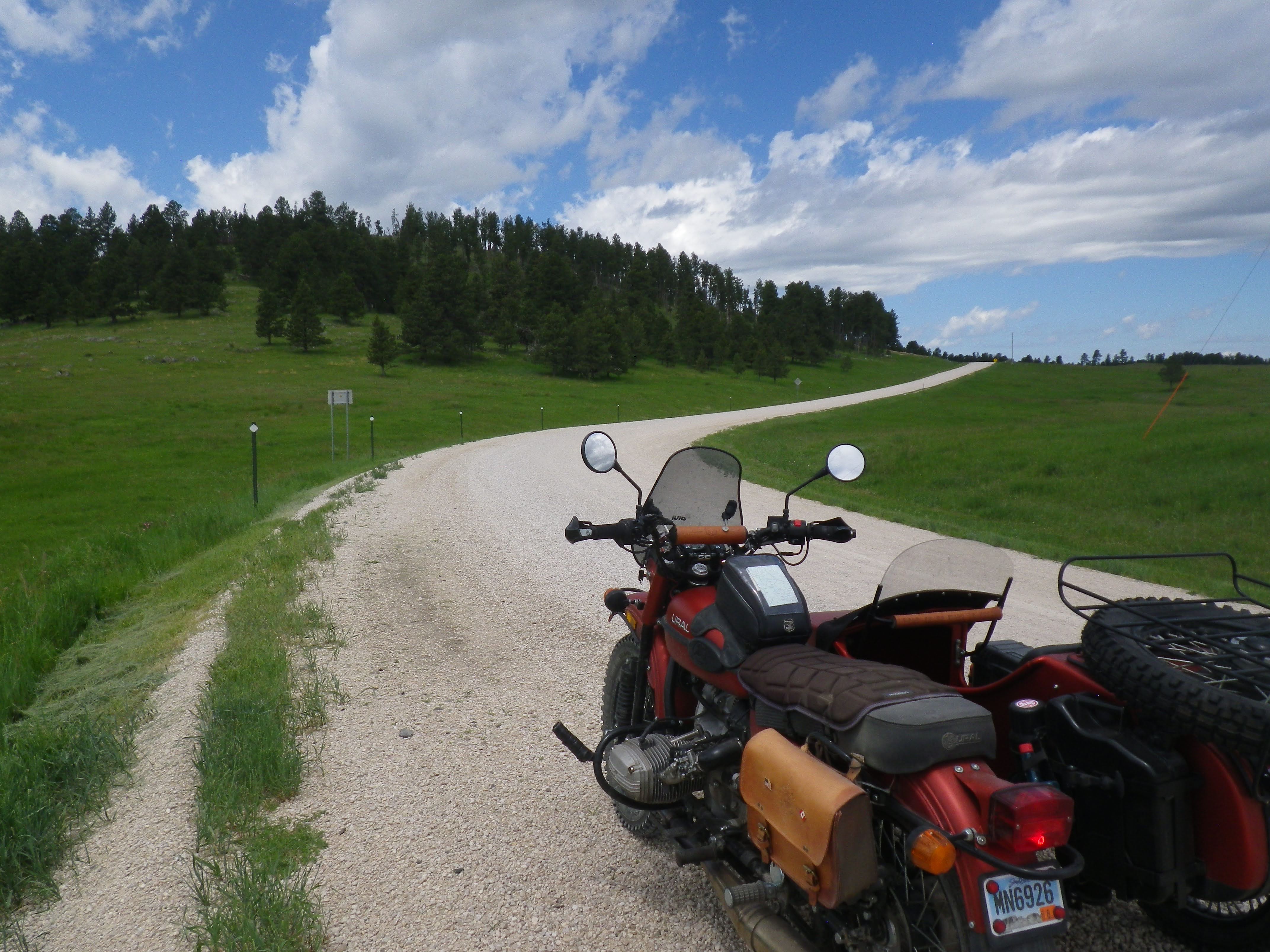
From our house, I rode about 20 miles to gas up in Hill City - a small town of less than a thousand souls. Of course, being a tourist destination, its population swells considerably in the summer months! From there, I took the road towards Deerfield Lake - paved, but far from congested. This first photo was taken at the junction with Slate Prairie Road. After this short approach you can see here, it would be my entrance point into the vast network of fairly well maintained gravel roads that crisscross the nearly 1.3 million acre Black Hills National Forest in South Dakota and Wyoming.
In my limited experience thus far, there are many sections of the forest that look more like, well, forests. But this central part is a mix of trees and open grasslands that lift the eyes skyward. And from the looks of it, today was going to be a perfect one for gazing at the clouds!

Which would be just what I needed - a nice open landscape, with enjoyable but non-technical roads. You see, I had some pondering to do. And motorcycling is good for that.

It looked like I wouldn't be completely alone, however. I'd be sharing the route with open-range cattle. I count at least eight in this photo, if you examine it carefully.
It was good to have the cows to contend with - and they were often in the middle of the road! They kept me somewhat grounded in the now, even as I contemplated a very uncertain future. A couple of days before, I received the results of some MRIs I'd had on my back and neck. For over a year, I've had partial numbness in the outside edge of my right foot, that has gradually crept towards the inside, and even up my calf. Months ago, back in Oregon, I had some nerve conductivity tests that had shown no major issues. That doctor and I had decided to wait a while and see if things improved or worsened.
Once Kim and I were settled In Rapid City, my new neurologist and I decided it was time to get some answers. More follow-up imaging and tests will be necessary, but last Tuesday I learned that I most likely have multiple sclerosis.

Besides taking some time off in an attempt to get my head around that bit of news, the objective of this half-day outing was to traverse the central part of the Black Hills, from our place on the eastern slopes outside of Rapid City, to the first paved road in Wyoming - and back. By my calculations, it would be about 140 miles round trip, with around 90 miles of it unpaved.
All the major intersections were marked, and I had a good paper map - of course. But when I got to this one, I was a bit confused. I did want to go to Highway 85 (in Wyoming) but according to my odometer, it wasn't quite time to head that way yet. Cold Creek wasn't on my map, but it was only 2 miles away, so I decided to turn to the right.

Unfolding the bigger, more detailed map, I soon located Cold Creek. Sure enough, it was to the north, not to the west, where I needed to go.


I was hoping there'd be a sign at the Wyoming border - for a cool picture, of course. But I hadn't seen one yet. By my best reckoning, this spot should have been fairly close. I stopped and took my new GPS unit out from my jacket pocket.
Yes, I know, I've caved to technology! But only a little. The unit I finally decided to purchase is an InReach Mini. It doesn't have a real screen, so it can't replace my trusty paper maps for navigation. But it CAN send text messages and e-mails from anywhere in the world, with no cell service required - supposedly. I'd tested it on a shorter ride a couple weeks before with moderate success. But I'd learned a thing or two since then. On this trip it was (again, supposedly) taking a point every 30 minutes as I rode and putting it on a map, so people I had previously sent links to could "follow" me along the route. I could also "check in" to a prearranged e-mail address whenever I wanted, sending canned messages to keep a loved one even more informed. And of course, it also has a dedicated SOS button to alert emergency services, if the need should ever arise.
Sending a message from here should also provide me with a point on a detailed map, so I could see just how close I was to the border - granted, only after I got home. I chose "All is well!" and pressed the OK button once I'd highlighted Send on the tiny monochromatic display.

In just a few more miles, the USFS road became a county road, and I began to pass ranch houses and even a road maintenance crew. Soon, a paved road appeared below me in the distance, and then this STOP sign. I had reached US Highway 85, which runs from the Canadian border to El Paso. But for today, I'd just cross it to that old, closed looking motel, take a short break, and head back.

The overhang provided the perfect Ural-sized shade. Turning off the engine and removing my helmet, we both began a well deserved cool-down! Originally a stage stop back in the gold rush days, I suppose the "town" of Four Corners got its name from the nearby junction of two Wyoming counties and two South Dakota counties.

The hanging on the door reads, "Happy Memories Are Made Here." I've already got a staggering amount of exceedingly happy memories - more than my fair share, without a doubt. But who couldn't use a few more?
"There've been a lot of advances in MS treatment in the last 10 years," the doc assured me. But there's still no cure, I knew. "How can you ride for hundreds of miles, on terrible Arctic roads, in punishing weather conditions, with very little variation in the scenery?" I've been asked. "Well, one mile at a time," is a favorite response. And some of those miles are not so bad, and others are inexplicably enjoyable! It is my prayer that life will imitate riding in that respect, as the reverse has been true since I was a child.

I am so sorry to read about the MS diagnosis, Troy!
ReplyDelete